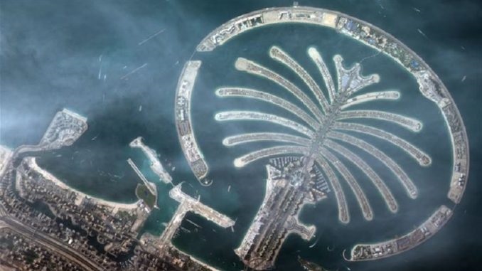
KhalifaSat, the first satellite built by Emirati engineers in the UAE, has sent the first image from space of Dubai’s Palm Jumeirah.
The Mohammed bin Rashid Space Centre (MBRSC) has confirmed that all the signals received by the control team at its ground station indicate that KhalifaSat is working properly from its orbit. The first image KhalifaSat took was for Palm Jumeirah, when it passed over the UAE on 31 October, 2018 at 1:32 pm from its Low Earth Orbit at about 613 km. Its speed is estimated at 7 km/s, which makes it orbit the Earth almost 14 and a half cycles daily.
MBRSC said that in the next phase, KhalifaSat will have a greater accuracy in geographic positioning and high-quality images. KhalifaSat’s image clarity is among the highest in the world to meet the needs of government and private organisations and institutions around the world. The satellite is currently in the ‘calibration phase’ during which operations of the basic and backup systems are monitored and necessary adjustments are made to the cameras.
‘KhalifaSat’ is the first Arab satellite designed and developed 100% by Emiratis in the UAE. It was launched from Tanegashima Space Centre in Japan on 29 October 2018. The Earth observation satellite is one of the most advanced satellites in its class worldwide. It has five patents to its name and seven space innovations.


Discussion about this post